☀️
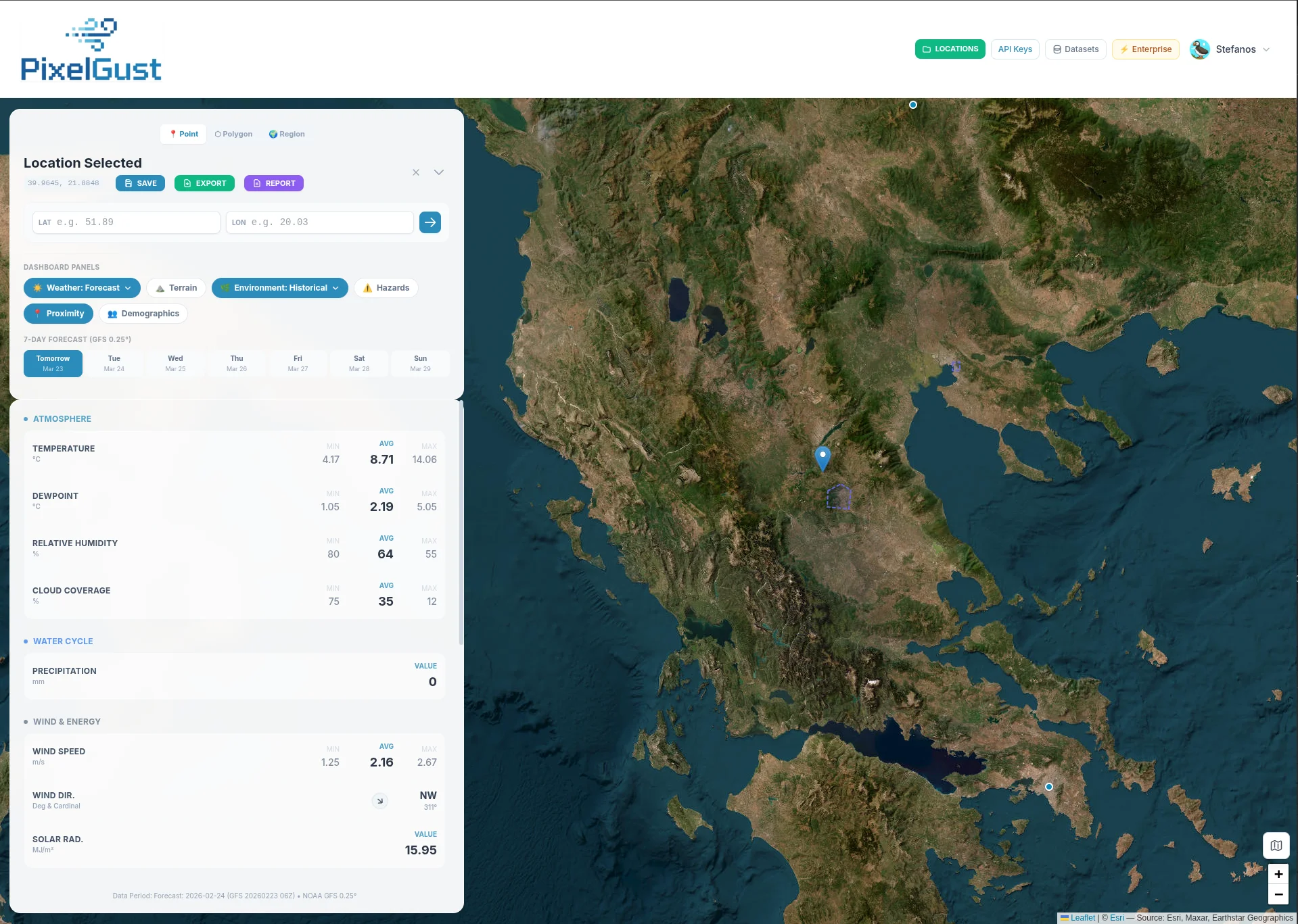
Real-Time Weather
Temperature, humidity, wind speed & direction, precipitation, cloud cover, solar radiation, and more, powered by NOAA GFS 0.25° data updated every 6 hours.
📅
7-Day Forecast
Day-by-day weather forecasts with all variables. Plan ahead with detailed predictions for temperature, precipitation, wind, and atmospheric conditions.
📊
Historical Data (2015–2025)
Access 10 years of monthly climate averages with min, max, and mean values. Visualize trends with interactive timeseries charts for every variable.
⛰️
Terrain Analysis
Elevation, slope, aspect, and Topographic Wetness Index at 30m resolution from the Copernicus GLO-30 DEM. Understand the landscape at any point.
🌿
Environment & Vegetation
NDVI vegetation index, evapotranspiration rates, and ESA WorldCover land cover classification. Track environmental health with historical NDVI trends.
⚠️
Hazard Assessment
Soil erosion risk (RUSLE model), fire weather index (FWI), and flood susceptibility (TWI). Identify natural hazard exposure for any location.
🟤
Soil Properties
Global 250m soil data from SoilGrids. Explore 61 depth-specific variables including pH, organic carbon, nitrogen, bulk density, and cation exchange capacity.
📍
Proximity Analysis
Distance to nearest roads, airports, ports, hospitals, power plants, and urban centers. Essential context for site selection and logistics.
👥
Demographics
WorldPop 2020 population density data at 1km resolution. Understand the human context of any location around the globe.
📄
Reports & Export
Generate comprehensive PDF reports and export data to Excel. Select exactly which sections to include. Perfect for documentation and analysis.